
 As I started my trip west out of Martinsville this morning, I almost immediately encountered my first geological obstacle of the trip - the Blue Ridge Escarpment, rising more than 400 m over just a few kilometers.Escarpments are steep slopes between two adjoining areas of different elevation. Martinsville is located near the western edge of Virginia's Piedmont physiographic province, and sits approximately 300 m above sea level. Traveling west on US 58, for the first 40 km the elevation only increases by about 100 m. But over the next 15 km the elevation increases by 450 m, a 10-fold increase in the average slope. Here's a photo from the top of the escarpment, looking back northeast toward the Piedmont:
 And a similar view, taken on an earlier trip from further north in Floyd County:
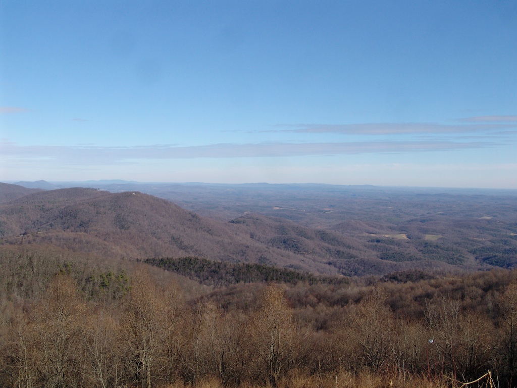 Escarpments often start as a fault that causes an elevation change, with the resulting slope eroding back over time. They can also form if there are rocks adjacent to each other that erode at different rates. But there is some debate about the origin of the Blue Ridge Escarpment. While there are lots of faults associated with the Piedmont and the Blue Ridge, the faults are mostly ancient, at least 200 million years old (although some eastern faults still show a fair amount of activity, as demonstrated by the Virginia earthquake of 2011). But a lithologic change is also not a good explanation, because the escarpment cuts across different rock types indiscriminately. There is evidence, however, that the escarpment is eroding back to the west, exposing the deeper Piedmont rocks in the process.The Blue Ridge Escarpment was a bit of a challenge for my fully-loaded truck towing a trailer, especially with the hairpin turns up the escarpment, but I was able to successfully reach the top and continue west.